
Meghalaya
“Abode of clouds and living root bridges”
Overview & Heritage
Meghalaya • Northeast India
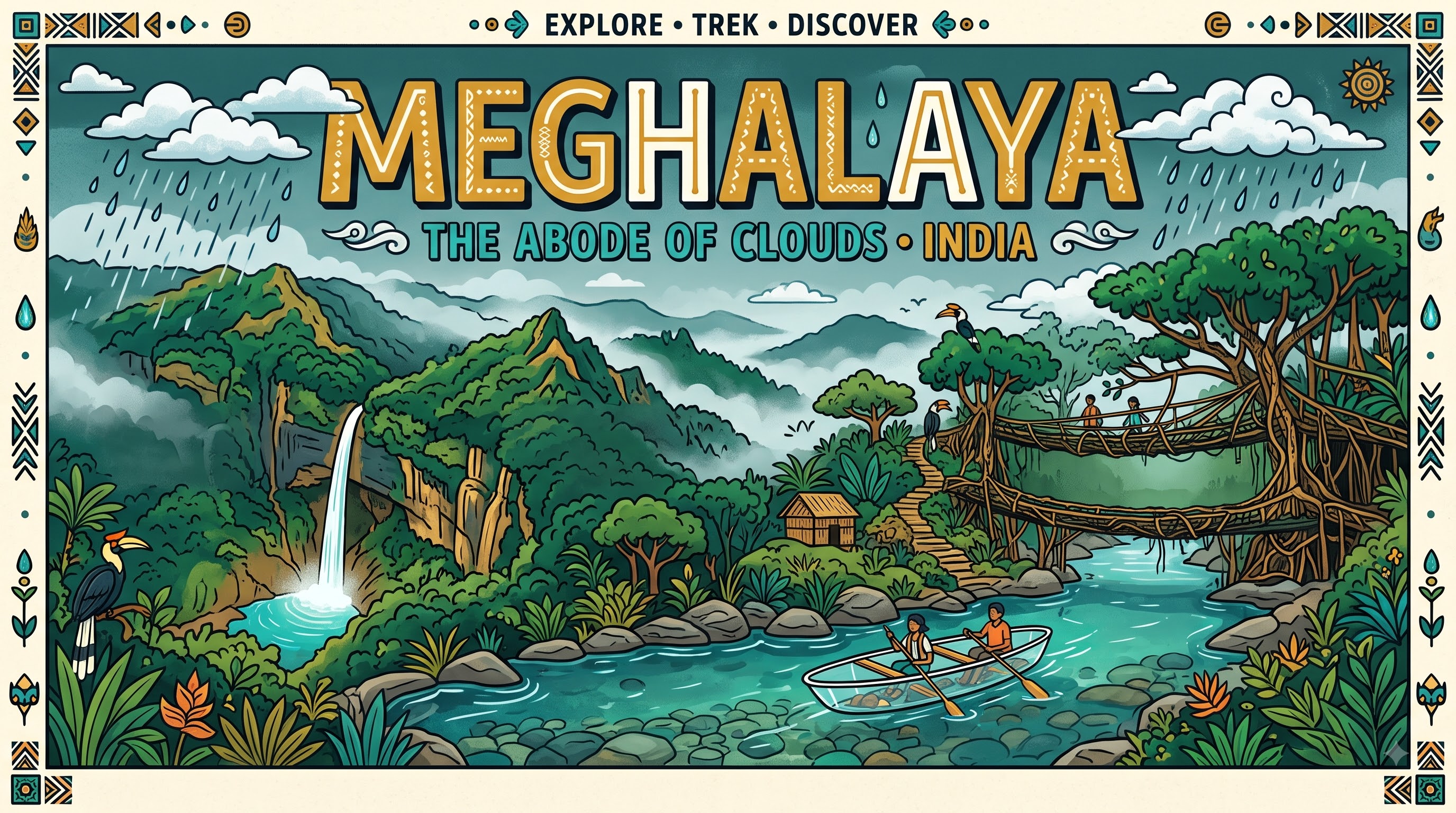
Meghalaya — Sanskrit for 'Abode of Clouds' — covers 22,429 km² on a sandstone and limestone plateau wedged between Assam to the north and east and Bangladesh to the south and west. If you keep one picture in mind, let it be this: a Khasi village where a living bridge woven from rubber-tree roots stretches over a misty gorge while monsoon clouds tumble over waterfalls. With a projected 3.4 million people (2025) and Shillong at 1,496 metres as its capital, Meghalaya feels more like highland Southeast Asia than the Gangetic plain. Carved as an autonomous state within Assam on 2 April 1970 and granted full statehood on 21 January 1972 under the North-Eastern Areas (Reorganisation) Act, 1971, it is home to the Khasi, Garo and Jaintia (Pnar) peoples. Unlike most of India, inheritance and lineage here pass through the youngest daughter. Annual rainfall can exceed 11,000 mm at Mawsynram and nearby Cherrapunji (Sohra), among the wettest places on Earth, feeding deep gorges, the 340-metre Nohkalikai Falls, limestone caves, and the crystal-clear Umngot River at Dawki that looks as if boats are floating on air.
“A cornerstone of Northeast India, Meghalaya embodies millennia of vibrant history, distinct geography, and legendary cultural traditions.”
History & Dynasties
Long before statehood, the hills of Meghalaya were a mosaic of tribal kingdoms and chieftainships. The Khasi states (Hima), each led by a Syiem, the Jaintia kingdom centred at Jowai, and the Garo Nokma-led villages developed distinct languages, matrilineal clans, and iron-smelting and terrace-cultivation traditions. The Jaintia rulers famously controlled limestone and coal routes to Bengal, while Khasi chiefs guarded the east-west trade between Assam and Sylhet. British annexation followed the Anglo-Burmese wars and the 1860s expeditions against Khasi resistance led by figures such as U Tirot Sing of Hima Nongkhlaw, who resisted British road-building. Under British India the hills were part of Assam, administered lightly with Christian missionaries introducing the Roman script for Khasi and Garo and establishing schools that gave the region early literacy. Shillong, made Assam's capital in 1874, remained so until Meghalaya's formation. The Hill State Movement of the 1960s demanded separation from Assamese-dominated administration, leading to autonomy in 1970 and the creation of the full state on 21 January 1972 comprising the United Khasi Hills and Jaintia Hills and the Garo Hills. The peaceful democratic negotiation behind Meghalaya's birth is often highlighted as a contrast to more turbulent reorganisations elsewhere.
Nature & Geography
Meghalaya is essentially a single dissected plateau — the Meghalaya plateau, an extension of the Peninsular block — averaging 900 to 1,500 metres, with Shillong Peak at 1,965 metres as its highest point. The southern scarp falls abruptly to the Bangladesh plains, creating ideal conditions for orographic rainfall when moisture-laden Bay of Bengal winds hit the hills. Mawsynram, about 56 km from Shillong, receives an annual average over 11,800 mm and holds the Guinness World Record for highest average annual rainfall; neighbouring Sohra (Cherrapunji) once held the record and still records similar extremes. The plateau is karst: more than 1,700 caves have been mapped, including Krem Liat Prah, one of South Asia's longest cave systems at over 30 km, and Siju Cave with its bat colonies. Rivers run fast and short — the Umngot, Myntdu, Kynshi and Simsang cut deep gorges. Nohkalikai Falls near Sohra plunges 340 metres, the highest plunge waterfall in India, while Krang Suri and Elephant Falls are classic excursion sites. Forest cover exceeds 75% with subtropical broadleaf, pine and grasslands, sheltering the clouded leopard (state animal), hoolock gibbon, and the lady's slipper orchid (state flower). Nokrek National Park in Garo Hills is a UNESCO Biosphere Reserve protecting wild citrus diversity, notably Citrus indica. Peat bogs, living root bridges of Ficus elastica trained over decades across streams, and sacred groves such as Mawphlang conserve both ecology and culture.
Culture & Arts
Meghalaya's most studied cultural feature is matriliny. Among all three major communities, lineage (kur), residence after marriage, and inheritance of ancestral property pass through the mother to the youngest daughter (Ka Khatduh in Khasi), who also cares for aging parents. This does not mean matriarchy — political leadership has historically been male — but it creates a distinctive kinship system studied by anthropologists worldwide. Language supports this identity: English is the official language, while Khasi — a surviving Austroasiatic Mon-Khmer tongue with no original script until missionaries added Roman letters — and Garo (a Tibeto-Burman language) have been accorded associate official status. Music defines modern Meghalaya; Shillong is widely called the 'Rock Capital of India', hosting an influential Western music and indie scene since the 1970s alongside folk instruments like the duitara and drums. The anatomical craft of living root bridges — aerial roots of Ficus elastica guided across rivers with bamboo scaffolds for 15 to 30 years until they can bear human weight, then living for centuries — blends engineering and reverence for nature. Key festivals include Shad Suk Mynsiem (Khasi thanksgiving dance in April), Nongkrem Dance, Wangala (Garo hundred-drum harvest festival in November), and Behdeinkhlam. Cuisine leans on rice, pork, smoked fish, bamboo shoot, and the fiery Dak-Galka, best explored in community-run village homestays.
Fun Facts
Mawsynram averages over 11,800 mm of rain a year, recognised by the Guinness World Records as the wettest place on Earth; the meteorological station at nearby Cherrapunji once recorded over 26,000 mm in a single year (1860-61).
The double-decker living root bridge at Nongriat near Cherrapunji, grown from Ficus elastica aerial roots, has been trained for more than a century and can hold over 50 people at once.
Meghalaya's matrilineal system means the youngest daughter (Ka Khatduh) inherits ancestral property and the children take the mother's clan name — a system followed by the Khasi, Garo and Jaintia alike.
Krem Liat Prah in the East Jaintia Hills stretches over 30 km, making it the longest surveyed cave in South Asia, part of a karst network that is still being explored by international teams each winter.
The Umngot River at Dawki on the Bangladesh border is so transparent in winter that the riverbed is visible at depth and boats appear to levitate, thanks to minimal sediment in the limestone geology.
Shillong Peak (1,965 m) hosts an Indian Air Force radar station; access is regulated, but on clear days the view spans from the Himalayas to the plains of Bangladesh.