
Chhattisgarh
“The heavily forested herbal state of central India”
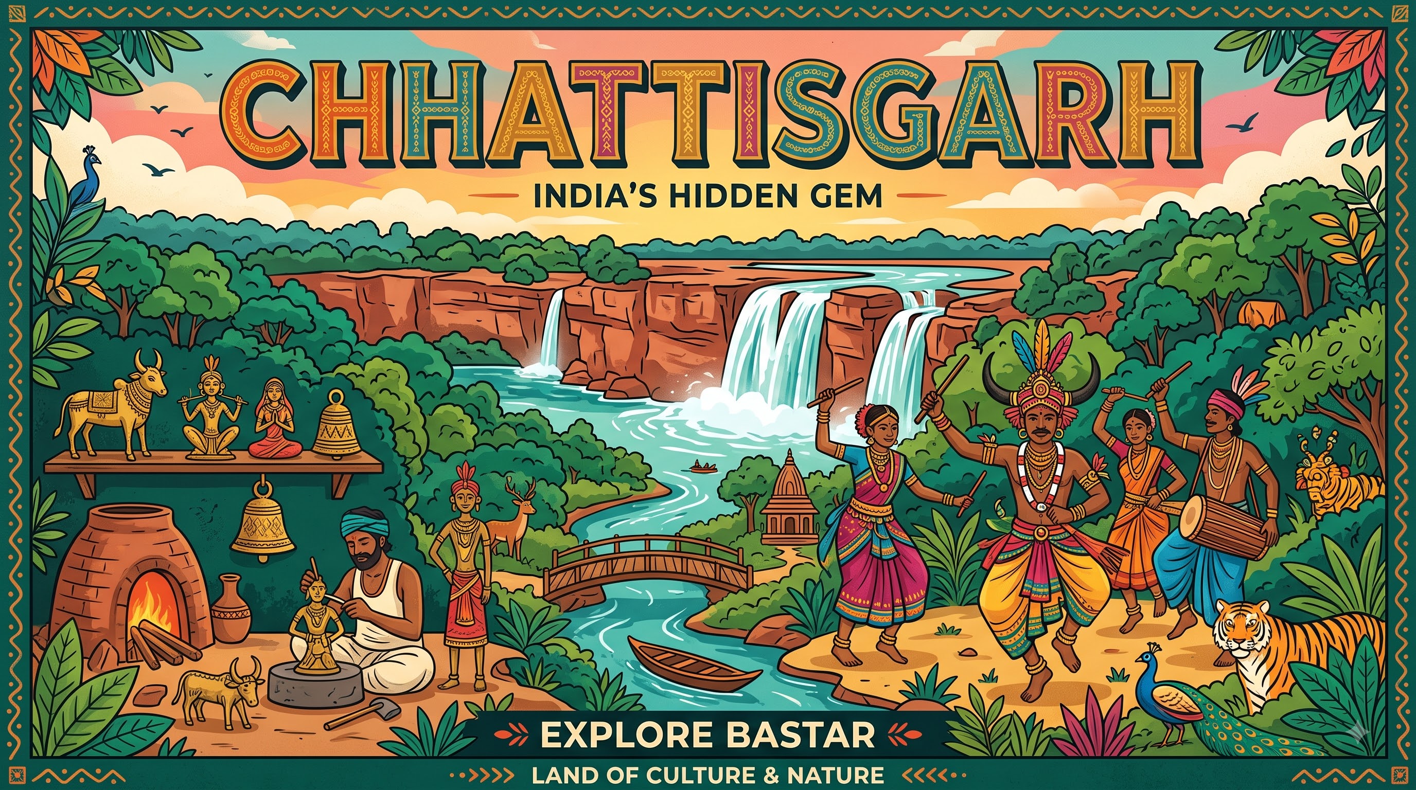
Overview & Heritage
Chhattisgarh • Central India
Chhattisgarh stretches over 135,192 km² across central India, making it the ninth largest state, with a projected population of about 30.1 million in 2025. Bordered by seven states — Uttar Pradesh, Madhya Pradesh, Maharashtra, Odisha, Jharkhand, Telangana and Andhra Pradesh — it occupies the eastern edge of the Deccan plateau, rich in forests, minerals and river basins. Raipur, its capital and largest city, anchors an economy often called the rice bowl of central India. If you retain one framing idea, remember Chhattisgarh as a state carved from forests and ore: more than 41% of its area is recorded forest cover, it holds India's third largest coal reserves, and its rivers irrigate some of the country's most productive paddy lands.
“A cornerstone of Central India, Chhattisgarh embodies millennia of vibrant history, distinct geography, and legendary cultural traditions.”
Formed on 1 November 2000 after bifurcation from Madhya Pradesh, Chhattisgarh was created to bring governance closer to its large tribal population — about one-third of residents belong to Scheduled Tribes, among the highest proportions in India. Hindi and Chhattisgarhi are official languages, the latter recognised as an eastern Hindi dialect with its own literature and music. The state motto celebrates the Arpa and Pairi rivers, and its formation day, Rajyotsava on 1 November, is observed annually. For students of geography and development, Chhattisgarh illustrates the balance between resource wealth, forest conservation and tribal livelihoods.
History & Dynasties
Anciently known as Dakshina Kosala, the region appears in the Ramayana as the birthplace of Kaushalya, mother of Lord Rama, and in legend as part of Dandakaranya where Rama, Sita and Lakshmana spent years in exile. Archaeology at Sirpur, Barsoor and Malhar reveals early urban centres: Sirpur on the Mahanadi was a major Buddhist and Hindu capital between the 5th and 8th centuries, with brick temples like Laxman Temple from the 7th century, while the Jogimara and Sitabenga caves on Ramgarh Hills, dated to the 3rd century BCE Mauryan period, are considered among India's earliest theatre structures.
From the 6th to 12th centuries the region was contested among the Sharabhapuriyas, Panduvamshis and Somvamshis, before consolidation under the Haihaiyavansi (Kalachuri) kingdom at Ratanpur for nearly 700 years. The name Chhattisgarh itself — meaning thirty-six forts — was popularised under the Maratha era and first appears in an official document in 1795, though historians debate which 36 garhs were intended. In 1742 Maratha Bhonsales of Nagpur took control, ruling until the British annexed the territory in 1845 after the death of Raghuji III without an heir, administering it as the Chhattisgarh Division of the Central Provinces. Princely states including Bastar, Kanker, Surguja and Raigarh persisted until merger after Independence.
Demand for a separate state grew during the 1990s, driven by tribal representation and economic neglect within larger Madhya Pradesh. Under the Madhya Pradesh Reorganisation Act passed by Parliament in August 2000, Chhattisgarh became India's 26th state on 1 November 2000, with Raipur as capital. The state initially had 16 districts; today it has 33, organised into five administrative divisions.
Nature & Geography
Chhattisgarh sits between 17° and 24°N latitude, comprising three broad physiographic zones: the Chhattisgarh plain in the centre — a fertile rice basin drained by the Mahanadi and its tributaries Shivnath, Hasdeo, Mand and Pairi — the Maikal Hills of the Satpuras in the northwest, and the Bastar plateau in the south bordered by the Eastern Ghats. The Mahanadi, flowing about 286 km through the state before entering Odisha, is the lifeline, alongside the Indravati, Rihand and Arpa. Elevation ranges from about 300 metres in the plain to 1,240 metres at Bailadila's iron-ore hills.
Forest cover exceeds 55,000 km² (about 41.2% of the state, third highest among states after Madhya Pradesh and Arunachal Pradesh), dominated by sal, teak, bamboo and tendu, supporting wildlife including wild water buffalo — the state animal — hill myna, leopards and sloth bears. Climate is tropical monsoon: summer highs above 45°C in May, monsoon rainfall averaging 1,200–1,400 mm from June to September, and mild winters around 10–20°C.
Key natural sites include Chitrakote Falls on the Indravati River near Jagdalpur, a horseshoe cascade about 29 metres high and up to 300 metres wide during monsoon, often called the Niagara of India and the widest fall in India; Tirathgarh Falls in Kanger Ghati National Park; and Kanger Valley itself, which protects 34 km of limestone caves including Kutumsar and Kailash caves, with stalactites, stalagmites and endemic blind cavefish (Indoreonectes evezardi). Barnawapara and Achanakmar wildlife sanctuaries and Indravati National Park complete a conservation network that makes Chhattisgarh one of India's densest forest landscapes.
Culture & Arts
Culture in Chhattisgarh is defined by its tribal majority and the synthesis of folk performance, metal craft and agrarian festivals. Gond, Baiga, Maria, Muria, Dhanwar, Halba and Oraon communities together account for over 30% of the population, each with distinct dialects, ornaments and dance forms. Chhattisgarhi, a language close to Awadhi with about 12 million speakers, is the everyday tongue, while Hindi is used officially and in education.
Music and theatre carry epics orally. Pandavani, recognised by UNESCO documentation efforts, is a solo storytelling form where artists like the late Padma Vibhushan Teejan Bai recount Mahabharata episodes with rhythmic song and gestures; Raut Nacha portrays Yadav cowherds' dances after Diwali; Panthi is a spiritual dance of the Satnami community founded by Guru Ghasidas; and Sua Nacha is performed by women during Diwali using parrot puppets. Bastar's craft traditions are globally known: Dhokra or bell-metal casting through the lost-wax technique, iron craft from loha shilp, Kosha silk weaving, and Bastar wooden craft. Chhattisgarh produces Kosha (tussar silk) and Muga textiles that have received Geographical Indication tags.
Festivals include Bastar Dussehra — not the one-day Mysore model, but a 75-day ritual centred on the Danteshwari Temple in Jagdalpur, considered the longest Dussehra celebration in the world — Madai Festival markets where tribal groups gather, and Hareli and Pola celebrating harvest and cattle. Cuisine is rice-centric: chila (rice flour crepe), fara (steamed rice dumplings), bore baasi (fermented leftover rice eaten with chutney), and mahua preparations. Sirpur's ancient temples and Bhoramdeo Temple near Kawardha, called the Khajuraho of Chhattisgarh, reflect classical stone architecture.
Fun Facts
Chitrakote Falls on the Indravati is India's widest waterfall, reaching nearly 300 metres across during monsoon and dropping about 29 metres, forming a horseshoe shape often compared to Niagara.
Bastar Dussehra lasts 75 days from Shravan Amavasya to Ashwin Shukla Trayodashi, making it the world's longest Dussehra festival, centred on Goddess Danteshwari who is regarded as the kuldevi of Bastar.
Chhattisgarh holds the third largest coal reserves in India (about 18% of national reserves) and also major iron ore, bauxite and dolomite deposits; Bailadila in Dantewada supplies high-grade iron ore to national steel plants.
Kanger Valley's Kutumsar Cave, discovered in the early 20th century, is among India's longest limestone cave systems and hosts the endemic blind cavefish Indoreonectes evezardi, adapted to total darkness.
Pandavani exponent Teejan Bai, born in Ganiyari village, received Padma Shri, Padma Bhushan and Padma Vibhushan, and took this oral epic form to international audiences from the 1980s onward.
The state animal is the wild water buffalo (Bubalus arnee), and the state tree is sal (Shorea robusta), reflecting the forest identity; over 44% of the territory was declared an Herbal State to promote medicinal plants.