
Uttar Pradesh
“The heartland of northern India and ancient heritage”
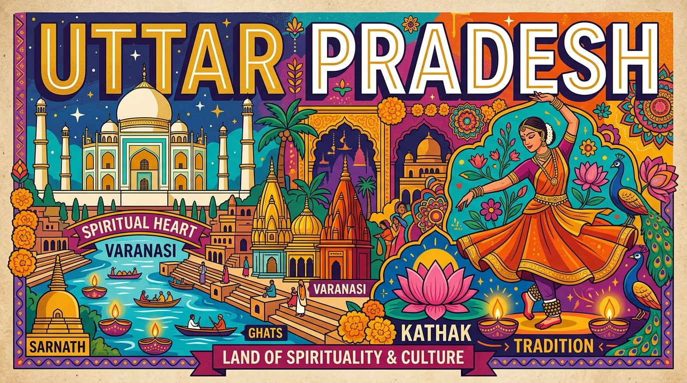
Overview & Heritage
Uttar Pradesh • North India
Uttar Pradesh lies in the vast, fertile heart of the Indo-Gangetic plain in north-central India, sharing borders with nine states and Nepal. It is India's most populous state — with a projected 246 million people in 2025, it would rank as the world's fifth most populous country if independent — and its fourth largest by area at about 243,290 km² (as per government data, with 240,928 km² also cited in some official sources). If a student remembers only one thing about UP, it should be this: the state is the hinge of Indian civilization, religion, and politics. It contains three of India's most visited human creations and pilgrimage centers — the Taj Mahal at Agra, the ghats of Varanasi on the Ganga, and the confluence at Prayagraj — alongside the birthplaces of Lord Rama at Ayodhya and Lord Krishna at Mathura. From sugarcane fields to Noida's tech corridors, UP is both ancient and urgently contemporary.
“A cornerstone of North India, Uttar Pradesh embodies millennia of vibrant history, distinct geography, and legendary cultural traditions.”
History & Dynasties
The land that is now Uttar Pradesh has been inhabited since prehistoric times, but written history begins with the Vedic period. The early kingdoms of Kosala (capital Ayodhya), Kuru, and Vatsa thrived here, and the epics Ramayana and Mahabharata are set partly on this soil — Ayodhya, Hastinapur, and Mathura are enduring literary and pilgrimage centers. In the 6th century BCE the Mahajanapadas of Kosala and Kashi dominated the region before being absorbed into the expanding Magadhan empires of the Mauryas (3rd century BCE) and Guptas (4th–6th century CE), when centres like Sarnath near Varanasi became great Buddhist sites after Buddha gave his first sermon there.
Medieval centuries brought Rajput clans, the Delhi Sultanate, and then the Mughals, who made Agra and later Fatehpur Sikri imperial capitals. Under Shah Jahan the Taj Mahal was built at Agra between 1631 and 1653 as a marble mausoleum for his wife Mumtaz Mahal — now a UNESCO World Heritage Site and one of the New Seven Wonders of the World. The 1857 War of Independence saw fierce battles at Meerut, Kanpur, and Lucknow; Lucknow's Residency still bears cannon scars. In 1937 the British formed the United Provinces of Agra and Oudh, renamed Uttar Pradesh after Independence in 1950 with Lucknow as capital. Uttarakhand was carved from its Himalayan north in 2000. Politically, UP sends 80 members to the Lok Sabha, the largest share, making it decisive in national elections — a fact every civics student encounters.
Nature & Geography
Uttar Pradesh can be read as three horizontal bands. The southernmost is the Vindhya Hills and plateau — rocky, drier, with forests of teak and tendu. The middle and largest is the Gangetic Plain, a flat, low-lying alluvial expanse sloping gently southeast at about 2 meters per km, formed by millennia of silt from the Ganga, Yamuna, Ghaghara, Gomti, Betwa, Ken, and Son rivers. The Ganga–Yamuna Doab (land between two rivers) is India's most fertile agricultural tract. The northern fringe is the moist Terai — marshy lowlands at the foot of the Himalayas bordering Nepal, where groundwater is high and forests are denser.
Climate is tropical monsoon: scorching summers (45°C not uncommon in Agra and Kanpur), a June-to-September monsoon that delivers 85% of rainfall, and cold winters with dense fog that disrupts rail and air travel. Wildlife is concentrated in the Terai. Dudhwa National Park in Lakhimpur Kheri, along with Kishanpur and Katarniaghat Wildlife Sanctuaries, forms the Dudhwa Tiger Reserve — a sanctuary for Bengal tigers, one-horned rhinos (reintroduced), swamp deer (barasingha, the state animal), and elephants. The Upper Ganga Ramsar stretch, Hastinapur Sanctuary, and Soor Sarovar Bird Sanctuary protect riverine and wetland habitats, while the Chambal ravines in the southwest host gharials and river dolphins. The state is largely deforested for agriculture, so these protected pockets are ecologically critical.
Culture & Arts
Uttar Pradesh is India's cultural textbook. The UNESCO-inscribed trio of Taj Mahal, Agra Fort, and Fatehpur Sikri showcases Mughal architecture at its peak; Varanasi's riverside ghats, where evening Ganga aarti lights the water with thousands of diyas, are considered among the most atmospheric sights in the world and Varanasi itself is often cited as one of the world's oldest continuously inhabited cities. At Sarnath, the Lion Capital of Ashoka — now India's national emblem — was found, and the Dhamek Stupa marks the Buddha's first teaching.
Classical traditions run deep: Kathak, one of eight officially recognized Indian classical dances, originated in UP's temples and Nawabi courts; Lucknow's Kathak gharana emphasizes expressive storytelling. Music gharanas of Agra, Varanasi, and Rampur shaped Hindustani classical music. Cuisine is equally storied — Awadhi cuisine of Lucknow (slow-cooked dum biryani, kebabs like galouti and seekh, sheermal), Braj's mathura peda, and Banarasi paan and chaat. Craft highlights include Banarasi silk sarees woven with gold brocade on pit looms, Chikankari embroidery from Lucknow, and Bhadohi carpets. Festivals mirror the state's syncretism: Kumbh Mela at Prayagraj (the world's largest peaceful gathering, gathering over 100 million pilgrims over its duration and UNESCO-recognized as intangible heritage), Deepotsav at Ayodhya, Krishna Janmashtami at Mathura, and both Diwali and Eid celebrated with equal fervour in shared neighbourhoods.
Fun Facts
As per projection data (2025), if Uttar Pradesh were a country it would be the fifth most populous in the world, ahead of Pakistan, Brazil, and Nigeria — a favourite statistic in general knowledge exams.
The Taj Mahal's white marble changes colour through the day — pinkish at sunrise, bright white by noon, and golden in moonlight — due to how marble reflects light; its construction employed over 20,000 artisans over 22 years.
Varanasi's Sankat Mochan and Kashi Vishwanath temples, Allahabad University (founded 1887 as the fourth modern university in India), and Lucknow's Rumi Darwaza (a 60-foot Awadhi gateway built in 1784) are all inside UP.
India's first war of independence in 1857 began at Meerut in UP when sepoys refused Enfield cartridges — an event taught in every Indian history textbook.
Noida's Jewar (Noida International Airport), under construction in the 2020s, is planned to be India's largest airport by area when fully completed, reflecting UP's rapid infrastructure push.
Dust from the Thar Desert and smoke from stubble burning often create a winter smog belt over western UP, but the state also leads India in sugarcane, wheat, and potato production — agricultural facts frequently tested in geography exams.